
Bull Creek District Park - Environmental Features Hike
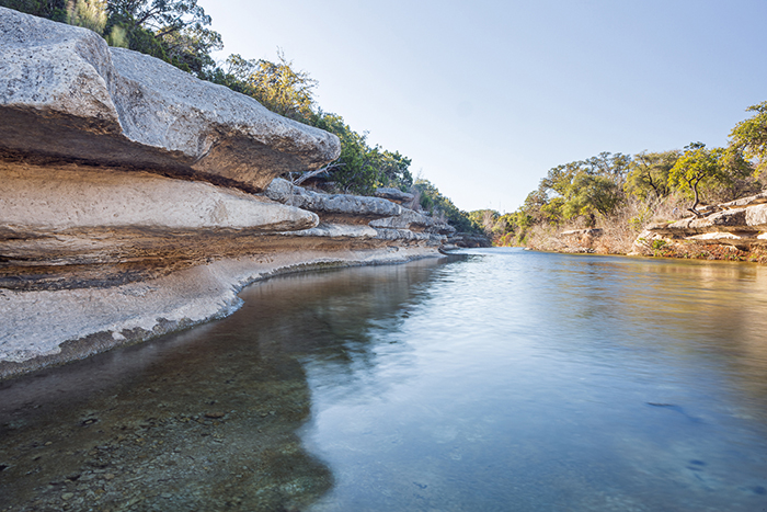
Bull Creek District Park, the anchor for the Upper and Lower Bull Creek Greenbelts, is one of Austin’s most popular parks. Beloved for its beautiful limestone outcroppings, springs, and cascading creek, this 47-acre park offers numerous recreational opportunities, including hiking.
To help enhance a visit to this park, we’d like to point out a few of the special environmental features that you might see. This includes some Critical Environmental Features (CEFs), such as springs and cliffs, which are protected from development by the City’s Land Development Code.
Please note that dogs are welcome at the park, but must stay on-leash.
Let’s explore the park!
Bull Creek District Park
6701 Lakewood Drive, Austin, TX 78731
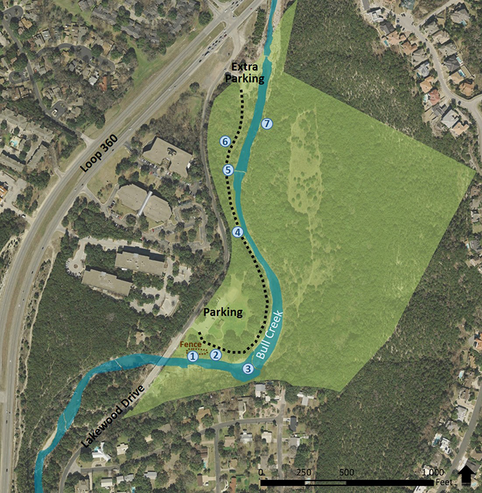
Key
1. Scooby Doo Spring
2. Grow Zone
3. Cascade
4. Cliff Spring
5. Dam Spring
6. Wetland
7. Canyon Rimrock
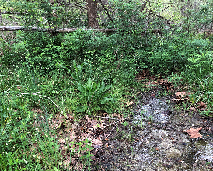
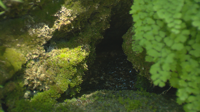
1. Scooby Doo Spring - This seasonal spring flows only when the underground water table fills with enough rainwater to reach the spring’s opening. Sometimes this spring’s water is not visibly flowing, and the ground is just damp. Water-loving plants and trees thrive in the area. Fun Fact: The spring’s name came from scientists who spotted a dog at this spot when they arrived to conduct research.
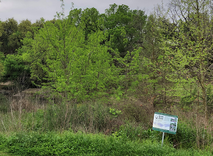
2. Grow Zone - This stretch of the creek bank is not mowed so that native plants can grow. Grow Zones help reduce water pollution by filtering out some pollutants from the land before they reach the creek. A healthy buffer of vegetation also slows down and absorbs fast-moving water from storms, helping reduce flooding and erosion problems in the area. For more information on the City’s Grow Zone Program to protect and restore creeks, visit www.austintexas.gov/blog/grow-zones.
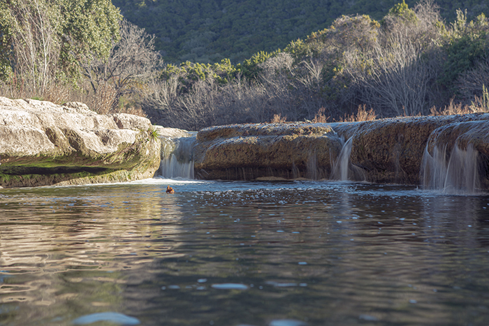
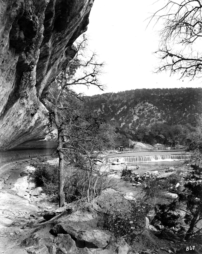
3. Cascade – These small waterfalls are located throughout the creek. Bull Creek was called Cascade Creek until the 1860s, when it was renamed for either the last buffalo that roamed the valley or for the free-ranging Longhorn cattle introduced at the time. The turbulence created by the creek moving over these rocky ledges helps aerate the water, adding more oxygen for wildlife, such as aquatic insects and fish.
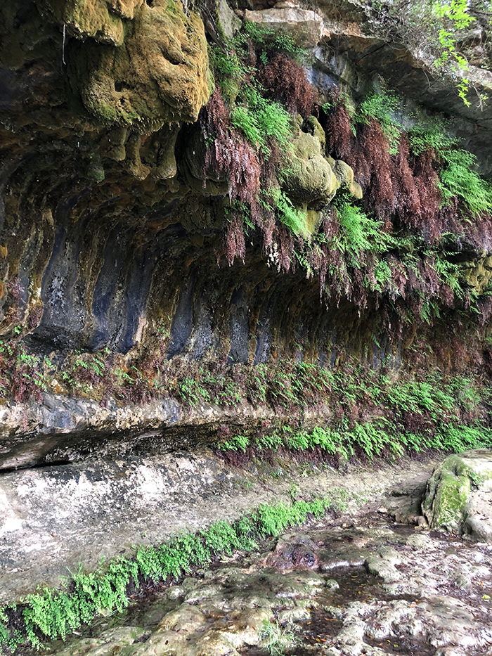
4. Cliff Spring – This spring flows through cracks in the ground and trickles from many spots in the cliffside, forming a “hanging garden” of maidenhair and river ferns. The rimmed pools at the base of the cliff form when the dissolved mineral calcite precipitates out of the water. This is the same process that creates stalactite and stalagmite formations in caves.
5. Dam Spring - This spring’s water emerges from a discrete opening in the cliff near the dam. The spring flow is intermittent, or not constant, so sometimes this spring is dry. The water flow does not appear to depend on rain, so the cause of this spring’s appearance and disappearance is a mystery yet to be solved.
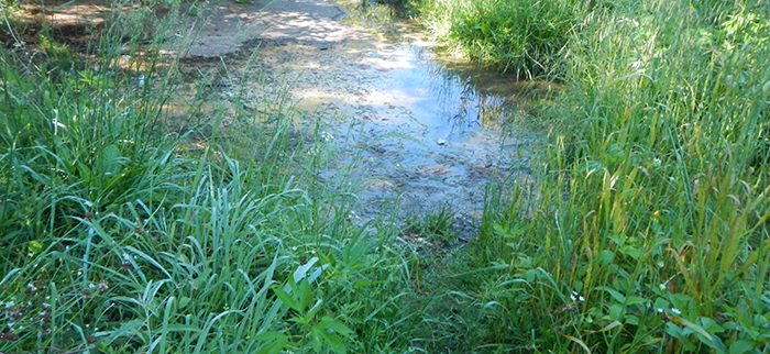
6. Wetland – This area is often covered in shallow water or saturated with moisture. To grow in this area, plants (such as spike rush and bushy bluestem) must be adapted to tolerate consistently saturated soils. The plants help protect the creek by capturing some of the sediment and pollutants from the trail and Lakewood Drive.
7. Canyon Rimrock - This is a type of sheer rock wall, greater than 50 feet long and four feet tall. The City prohibits construction near rimrock to help protect water quality in creeks and the stability of the rock wall.
To learn more about the fascinating history of Bull Creek, check out the Bull Creek Foundation.
For general information about parks in Austin, visit www.austintexas.gov/parks.
We hope you enjoy your hike!