
Blackland Prairie Study In East Travis County
For many years, the City of Austin’s Watershed Protection Department (WPD) has studied trees and other vegetation that grow along local creeks. These vegetated areas along the water are called “riparian buffers,” and they benefit our creeks and river by improving water quality and preventing erosion. Most of WPD’s riparian buffer studies have been in central and west Austin; however, a recent study took place in far eastern Travis County, around and east of U.S. 183. This area, located in the Blackland Prairie region, has deep, fertile soils and is mostly agricultural. WPD’s goal was to document conditions of the creeks and their riparian buffers before major development occurs there.
The results of the study surprised WPD staff, who expected to find forested land along the creeks in this less-developed area. Instead, these riparian buffers have much less plant diversity and fewer trees compared to more developed areas in central Austin (scoring, on average, half that of urban Austin sites). Even with little development in these Blackland Prairie watersheds, erosion has negatively impacted the area’s creeks. Severe erosion has caused the creek banks to be too dry to support strong vegetation. The lack of surrounding vegetation enables rainwater to enter the creek in powerful surges, leaving the creeks unable to support healthy aquatic habitat. WPD hopes these findings and further investigations will guide improvements to the City’s regulations and policies. These efforts will help restore watershed function to these degraded riparian buffers and protect them from future damage.
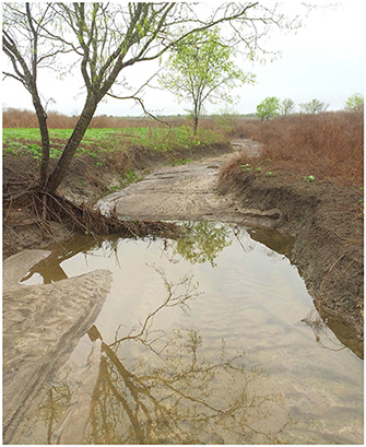
Creek banks without enough vegetation
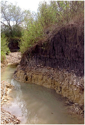
Creek with severe erosion