April 13, 2026
April 13, 2026
Wishbone Bridge: Closing the Loop on the Butler Trail

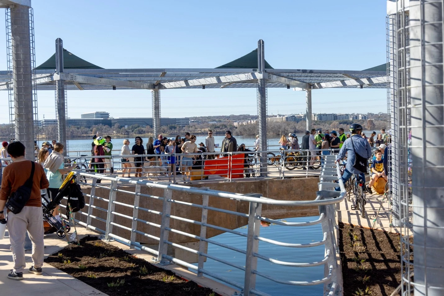
Lady Bird Lake is one of Austin’s most popular destinations for walking, running, and biking. The Wishbone Bridge, a pedestrian and bicycle bridge near Longhorn Dam, connects Longhorn Shores, Canterbury Street, and the Holly Peninsula along the Ann and Roy Butler Hike and Bike Trail.
Before the bridge was built, the eastern end of the Butler Trail had a major gap that required pedestrians and cyclists to detour onto the Pleasant Valley Road bridge, a high-crash roadway. The sidewalks there were narrow and located next to fast-moving traffic, creating safety concerns. The existing underpass beneath Pleasant Valley Road was only six feet wide, dimly lit, and prone to flooding.
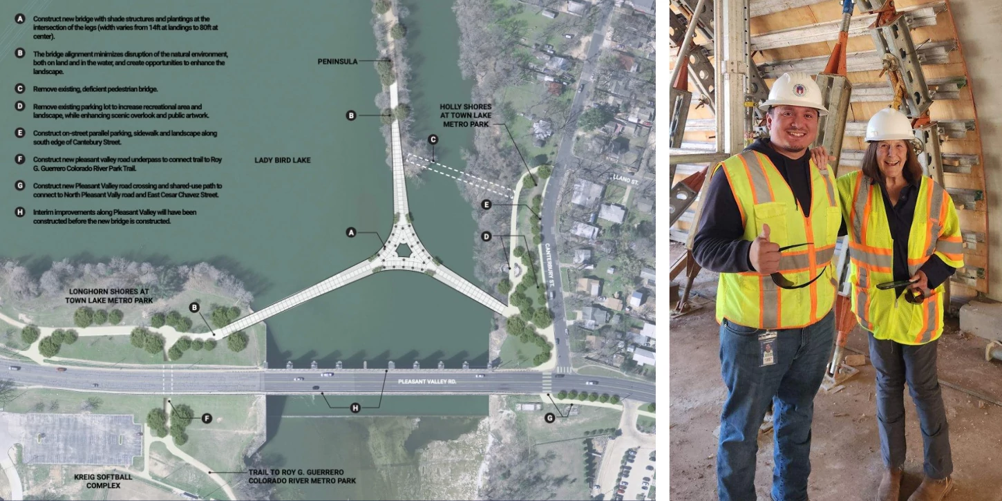
The Wishbone Bridge closes this gap, allowing trail users to travel along the eastern end of Lady Bird Lake without leaving the trail system. The wishbone-shaped bridge connects the trail at three points and was designed to improve safety and connectivity by providing an alternative to the Pleasant Valley Road crossing. Each leg extends more than three football fields in length, with a 24-foot-wide shared-use path that expands to approximately 65 feet in the central plaza to accommodate gathering space and high volumes of users. As project manager Laurie Thering noted, “The key purpose for both structures was safety and connectivity, and we were successful in doing that.”
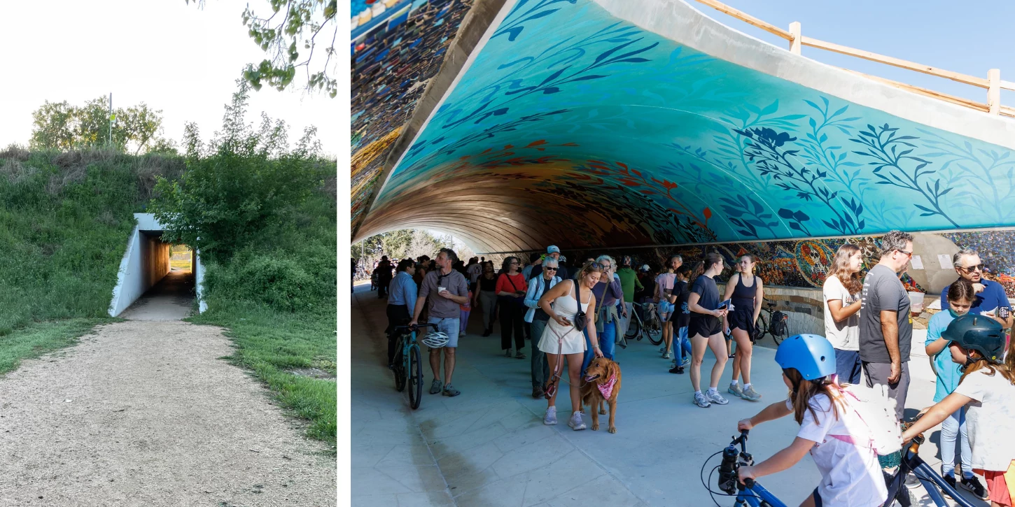
The project also included the Unity Underpass, a new 30-foot-wide, 16-foot-tall, 165-foot-long tunnel beneath Pleasant Valley Road with improved drainage and lighting. The underpass features public art by artist Reginald Adams, created using tiles made by more than 200 community members.
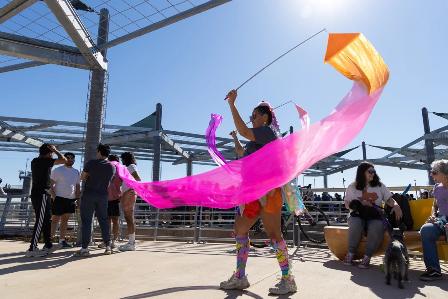
In addition to the bridge and underpass, the project includes amenities that enhance the user experience. The Trail Conservancy donated 14 brightly colored benches, known as “maraca benches” for their distinctive shape, which are installed throughout the plaza area. An additional 17 benches are planned over the next two years. The project also included extensive landscaping improvements, with more than 85 trees, 1,500 shrubs, and 1,500 plants added throughout the area using native or adaptive species.
Planning began in 2018 with a preliminary engineering study. Design and permitting took place between 2021 and 2023, with construction starting in July 2024 and finishing in February 2026, four months ahead of schedule.
This project was funded through the 2020 Mobility Bond Program and was delivered under budget, with a standard project budget of approximately $25 million. The City held a ribbon-cutting ceremony on February 7, 2026, with Mayor Kirk Watson, Congressman Greg Casar, Congressman Lloyd Doggett, and Council Members Paige Ellis and José Velásquez in attendance.
The bridge fills the largest remaining gap in the Butler Trail and provides a safe, car-free crossing while strengthening connections between nearby neighborhoods, parks, and trail destinations. It also creates a seamless, traffic-free connection along the full 10-mile Ann and Roy Butler Trail loop. Community response has been overwhelmingly positive, with many residents expressing appreciation for the improved safety and accessibility. As Thering said, “The most common comment we hear is, ‘Thank you, we really needed this.’”