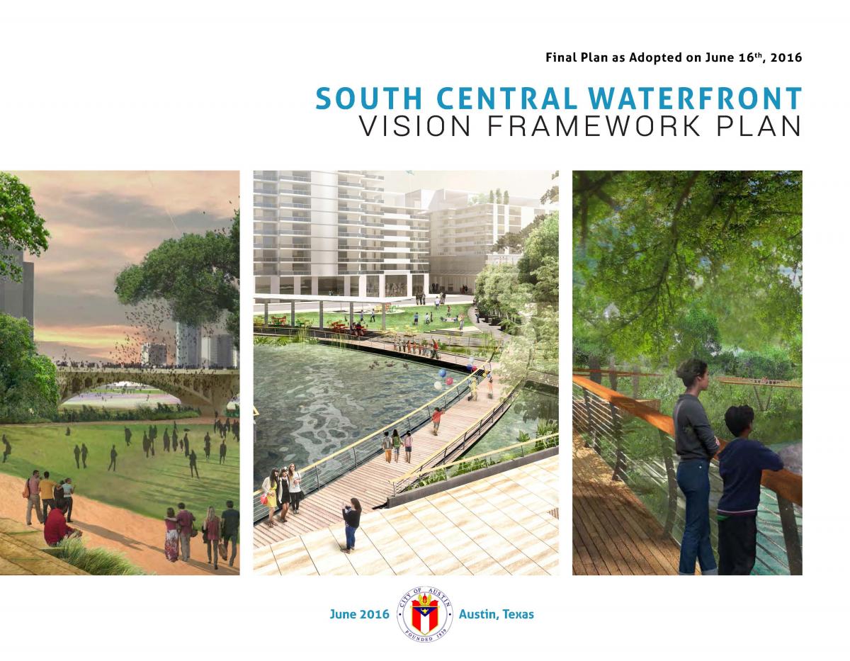
The South Central Waterfront Initiative promotes a vision and a set of recommendations, tools, and programs to guide redevelopment for this area over the next 20 years. The goal is to ensure that, as the area inevitably changes, every increment of change will contribute to making a great new district that:

  • Establish a lively, safe, and attractive pedestrian environment.
  • Expand open spaces and create great public places.
  • Enhance connections to and along the waterfront.
  • Include 20% new housing units as affordable.

The South Central Waterfront (Map) encompasses 118 acres, comprised of 32 separate private properties, directly across the lake from downtown. 

Please visit the tabs below for more information on the South Central Waterfront Initiative.

The Vision Framework Plan

The City Council adopted the South Central Waterfront Vision Framework Plan (South Central Waterfront Plan) as an amendment to Imagine Austin in June 2016. The South Central Waterfront Plan sets a path to create a districtwide network of connected green streets, parks, trails and public open spaces (approximately 20 new acres), as well as achieving 20% new affordable housing units (approximately 530 units). 

SCW Vision Framework Plan (PDF) (Final Plan as adopted)

Appendices to the SCW Vision Framework Plan (PDF)

SCW Preliminary Project & Financing Plan (PDF) -- Added Dec. 2021

Bringing the Vision to Life

The South Central Waterfront Plan recommends a series of implementation measures including development of regulations, adoption of innovative financial tools, fostering public-private partnerships, leveraging the single city property at One Texas Center for affordable housing, and capital improvement investments in infrastructure.  A newly formed South Central Waterfront Advisory Board (Web) is working with staff and stakeholders to provide recommendations to the City Council on implementation. The Implementing the Plan (Web) provides more information.

Awards & Recognitions

2017 Award for Excellence in Sustainability | American Planning Association’s Sustainable Communities Division

2017 Honor Award for Planning & Analysis | American Society of Landscape Architects, Texas Chapter

2016 Plan of the Year | American Planning Association, Texas Central Chapter

History of Waterfront Planning

Planning studies for the waterfront that date back 30 years have consistently called for harmonious development which respects the tremendous asset of the lake and shoreline. 

History of the South Central Waterfront

For the first 120 years since Austin was founded the area now known as the South Central Waterfront (SCW) was river bottom and floor plains. With the creation of Town Lake (now Lady Bird Lake) in 1960 the SCW finally had a stable bank and became developable. But unlike the downtown which had a grid of streets and blocks from the beginning, the SCW had no physical framework to orchestrate orderly development.

A view from the south side of the river, looking north in the early 1900's. Photo courtesy, Austin History Center.

photo of the waterfront in the early 1900's

Since its creation of the lake in 1960 the Lady Bird Lake corridor is one of Austin’s most distinctive and valuable natural assets, as well as one of Austin’s most beloved places. Formerly known as Town Lake, the lake was renamed in 2007 to honor long-time Austin resident Lady Bird Johnson (wife of President Lyndon B. Johnson) and her contributions to spearheading the Town Lake Beautification Project in 1970’s.

Past Planning Efforts

Further planning studies for the waterfront that date back 30 years have consistently called for harmonious development which respects the tremendous asset of the lake and shoreline. Planning studies specifically for the vicinity of the South Central Waterfront over the past 15 years have consistently noted that a lack of a good network of streets and blocks is a prime obstacle to harmonious development. Some of those key studies for the waterfront in general and for the South Central Waterfront vicinity in particular are shown below.

2016
The "Greening of the South Central Waterfront" Report is the result of a federal Environmental Protection Agency (EPA) award. Austin received assistance to help visualize great public open spaces, green infrastructure improvements, and safer spaces for people to walk and bike in the South Central Waterfront area. The report illustrates design options to improve pedestrian and bike connections to Lady Bird Lake and incorporate green infrastructure elements to reduce runoff and localized flooding, improve water quality, and increase shade.

Portions of the EPA report (Web) have been integrated into the adopted South Central Waterfront Vision Framework Plan. 

Illustration of proposed South Central waterfront

2014
The Interim Draft Vision Framework Report, August, 2014 (PDF), was created in response to the City Council directive to report the results of initial community engagement for the South Central Waterfront (SCW) Initiative. This Report incorporates best practices and previous studies for the SCW, and represents an early, interim stage in achieving a fully realized SCW Small Area Plan.
The draft Vision Framework identifies three key requirements in order to realize community aspirations for the SCW:

A Physical Framework for a district-wide vision, not a parcel-by-parcel approach, to provide an integrated network of connecting streets, pedestrian connections, open spaces, and green infrastructure. A Financial Framework to capture the district-wide value of investments, both public and private, in order to realize the Physical Framework and to include affordable housing. An Active Partner Framework that will ensure that the City of Austin, by making strategic capital investments, is a proactive stakeholder helping to bring about public/private partnerships required to achieve the Physical and Financial Framework goals.


The Town Lake Corridor Study called for developing long-range comprehensive plans to address both the water’s edge and urban edge. To date, this has not been accomplished for several key locations. The study also led to the creation of the 1986 Waterfront Overlay Combining District Ordinance.

2013
The Austin City Council resolved to initiate a comprehensive small-area plan for the South Central Waterfront. The August 2013 Council resolution (Web) cites that this area faces unique challenges as development pressures rise, and that the current land development codes and the waterfront overlay ordinance are not adequate to guide development in a way that will fully achieve the goals of the Town Lake Corridor Study. In August 2013, the Austin City Council resolved to initiate a comprehensive small-area plan for an area designated, for this planning initiative, as the South Central Waterfront.

The Sustainable Places Project was a region-wide effort to help Central Texas communities align their planning and investment choices with their community values to create healthy and sustainable activity centers. As part of this federally-funded grant, the Sustainable Place Project (SPP) utilized a computer-based analytic tool to assess and compare the financial, environmental and social impacts of three potential redevelopment scenarios for the South Shore Central (87 acres within the South Central Waterfront). The SPP analysis modeled: Scenario 1 following the current economic treads and existing regulations; Scenario 2 based on a version of the Report from the AIA Sustainable Design Assessment Team (SDAT); and Scenario 3 from the University of Texas School of Architecture/Texas Futures Lab. View the 2013 SPP Scenario Planning Report (PDF).

2012
The Council appointed Waterfront Planning Advisory Board (Web)(WPAB) for engagement with Austin’s citizens in city-wide public workshops. For the past two years the WPAB has supported two key planning initiatives for the South Central waterfront area:

Each of these initiatives provided opportunity for public input, analysis, and preliminary recommendations on how to best achieve the principles of the 1985 Town Lake Corridor Study.

In 2012, Austin was one of seven communities nationwide to win a grant for technical and design assistance from the AIA/SDAT public service program. As part of the SDAT program, Austin hosted a team of national sustainable design experts who worked with more than 200 citizens, City staff and officials, and other stakeholders. The City of Austin received the final October 2012 AIA Sustainable Design Assessment Team (SDAT) report (PDF).

1986
The 1986 Waterfront Overlay Combining District Ordinance, remains in effect today, much as it was when first enacted. The Ordinance was established to protect and enhance the waterfront while providing a framework for future development. The Ordinance established 15 sub-districts (now 16) along the 5.4-mile Town Lake Corridor.

1985
Forward-looking waterfront planning has been rooted in the 1985 Town Lake Corridor Study. This study, conducted in 1985, established broad principles and goals to promote that future public and private development along and near the lake be in harmony with protecting the waterfront, enhance public access along and to the shoreline, and encourage excellence in urban design.

Town Lake Corridor Study

Stay Informed

Stay up to date on South Central Waterfront news and events by using the following resources:

See the Implenenting the Plan section below for more info on how the Vision is becoming reality. Subscribe to receive e-mail updates and invitations to public meetings (coming soon). Watch & Learn about the initiative through the video gallery. Engage with the newly formed South Central Waterfront Advisory Board (Web).


Implementing the Plan

The South Central Waterfront Plan established a conceptual framework for allowing site-specific building enhancements in exchange for on-site and districtwide community benefit contributions. Analysis forecasts that implementing the Plan will unleash $2 billion of private investments over the next 15 years. The SCW Plan includes a series of Next Steps Recommendations (PDF) to leverage public and private investments and realize a districtwide network of connected green streets, parks, trails and public open spaces (approximately 20 new acres), as well as achieving 20% new affordable housing units (approximately 530 units). 

What’s Happening Now

Below are some of the Next Step Implementation items that have been completed or are in progress:

South Central Waterfront Advisory Board (SCWAB)

City Council has established the SCWAB to “provide continuity and communication among stakeholders and advocates as the South Central Waterfront Plan moves toward implementation and to provide recommendations to the city council regarding plan implementation.”  The SCWAB is already busy, working to implement the SCW Vision. See the web link for the South Central Waterfront Advisory Board, for information about its duties, membership, meeting agendas and materials, and future meetings. All SCWAB meetings are open to the public.

South Central Waterfront Regulating Plan

A draft of the SCW Regulating Plan has been developed with support from consultants, and is under review by the SCWAB. In spring 2018, staff will engage property owners and public, and proceed with reviews from other boards and commissions. The goal is to present the Regulating Plan to Council for potential approval in tandem with adoption of a new Land Development Code under CodeNEXT which contains the reference text under the South Central Waterfront Overlay Zone that empowers the Regulating Plan.

These two steps will set up the regulatory framework for properties to opt-in to the SCW Plan. Adoption of these regulations unlocks the development potential of the district that would fuel the Plan's funding tools to finance the SCW Vision.

South Central Waterfront Funding Tools

The SCWAB submitted a resolution to City Council on October 30, 2017 to commence a Tax Increment Finance (TIF) study and draft a TIF ordinance for the South Central Waterfront district. As forecasted in the SCW Plan, a TIF district provides the financial backbone to implementing the ultimate vision.

Nightwings Plaza

The SCW Plan identifies “Barton Springs Plaza” (aka: Nightwings Plaza) as a catalytic open space opportunity to jumpstart the SCW Vision. Building the permanent plaza is some ways off, so the SCW Plan calls for creating a temporary plaza to test the concept, using low-cost and temporary materials and working in partnership with community partners.

City staff and community partners, which include The Austin Parks Foundation and local businesses, have collaborated with the Public Works Departments’ Neighborhood Partnering Program and the Ausitn Transportation Department's Sidewalk Cafe Program to create a much grander 12-month demonstration plaza. We’re looking to cut the ribbon on that temporary plaza in spring 2018. Stay tuned!

Bouldin Creek Trail & Canopy Walk

Another key open space opportunity in the SCW Vision is to create a multi-use trail along Bouldin Creek, connecting South First Street and Congress Avenue. The City has worked closely with the Texas School for the Deaf (TSD) throughout the planning process, and in particular to conceptualize how this trail might fit on their property, providing mutual benefits and connectivity for their campus and the wider neighborhood.

Good News! The TSD references the SCW Plan and includes the vision of this trail in their Campus Master Plan 2017. TSD and City staff and officials are exploring how this mutual vision can become a reality.


Past Presentations

Check out our gallery of presentations and videos from previous public events.

Barton Springs Pop-Up Plaza | June 3, 2017

The South Central Waterfront Initiative coordinated with Our Congress Avenue to transform the northwest corner of Congress Avenue and Barton Springs Road into a Pop-Up Plaza. The pop up hosted a family friendly park with food trucks, games, and an opportunity to envision what the space could be. This one-day transformation is a preview of what the SCW team hopes will turn into a year-long demonstration project to bring more public space to Austin’s south shore. The plaza is part of a larger plan to realize the community’s vision for the South Central Waterfront district. Click here for a short video about the event.

SCW PopUp Plaza

City Council | June 16, 2016
Planning Commission Public Hearing | May 24th, 2016

Watch a recorded presentation and discussion

City Council Work Session | April 5, 2016
Planning Commission | April 12, 2016

Watch the recorded presentation and Planning Commission discussion

TALKabout #6 | May 23, 2016

A small crowd came out to hear SCW consultants Margaret Robinson of Asakura Robinson and Abe Farkas of ECONorthwest talk in detail about how their work contributed to the physical and financial framework found in the SCW Vision Framework Plan (Draft). 

Open Air Open House | May 1, 2016

Long time followers of the SCW Initiative as well as those just learning about the plan enjoyed ice cream and music while checking out the latest waterfront information and talking with City staff. Families dropped by to pet a few furry friends in the petting zoo and see a large 3D model of the district. Thank you to all who came out and made this a fun and educational event.

Walkshop | September 26, 2015

Design Workshop and Open House | September 3, 2015

Video of the presentation

Presentation slides (in PDF format):

Introduction Presentation by Alan Holt Wrap Up Presentation by Scott Cataffa and CMG Landscape Architecture

TALKabout #5: Designing Urban Landscapes for People and Nature | July 8, 2015

Scott Cataffa is principle of CMG Landscape Architecture, a nationally renowned design firm. CMG is working with Austin to design the green infrastructure network for the South Central Waterfront. During this talk, Cataffa showed examples of how his firm has worked in communities to integrate nature into the built environment.

Presentation slides (in PDF format):

Introduction presentation by Alan Holt Designing Urban Landscapes for People and Nature by Scott Cataffa

TALKabout #4: Principles for Remaking the Urban Waterfront | May 6, 2015

Internationally renowned urban designer, Harvard professor, writer and global expert on riverfront planning, Alex Krieger delivered a talk on the principles for creating vibrant, beautiful, and welcoming waterfronts.

Video of the presentation

Presentation slides (in PDF format):

Introduction presentation by Alan Holt Principles for Remaking the Urban Waterfront by Alex Krieger, FAIA

Presentation to the Comprehensive Planning & Transportation Subcommittee (CPTC) of the Austin City Council | June 30, 2014

Video of the presentation

Vision and Design Intensive | April 24-28, 2014

WALKabout #2: Connections | April 5, 2014

TALKabout #3: Dollars & Sense | March 24, 2014

Video of the presentation

Presentation slides (in PDF format):

Introduction presentation by Alan Holt Smart Strategies to Fund the Future by Rebecca Leonard Thriving Urban Waterfronts by Abe Farkas

TALKabout #2: Green Spaces, Urban Places | February 12, 2014

Video of the presentation

Presentation slides (in PDF format):

Introduction presentation by Alan Holt Ecologically Integrated City by Dean Almy


TALKabout #1: Imagining the Future | January 21, 2014

Video of the presentation

Presentation slides (in PDF format):

    Introduction presentation by Alan Holt, City of Austin     Sustainable Design Assessment Team (SDAT) by Harris Steinberg     Sustainable Places Project analysis by John Fregonese

WALKabout #1: Kickoff | January 11, 2014

CityView segment | March 10, 2014

Public Input CityView Segment | January 29, 2014

Sustainable Places Project | May 2013

Video of Part I

Video of Part II

Sustainable Design Assessment Team (SDAT) | June 2012

Video of Part I

Video of Part II

Video of Part III