Groundwater
Groundwater is an essential source of fresh water that is found underground in aquifers. In Austin, aquifers provide water to over 1,500 springs! Springs are places where groundwater flows onto the surface.
About Our Work
Austin Watershed Protection's work to protect groundwater includes:
- Monitoring the abundance and quality of groundwater in the Austin area
- Studying groundwater systems that provide water to springs throughout the area, including Barton Springs.
- Providing technical expertise on geologic and groundwater matters, including:
- Mitigation for caves encountered during construction projects.
- Delineating Edwards Aquifer Recharge Zone boundaries for development regulations
- Consultation for excavation or tunneling projects that may disrupt baseflow or endangered species habitats
- Determining if unidentified water is the result of groundwater, leaking water, or wastewater infrastructure.
- Purchasing open space to protect and preserve water quality. Learn about Austin Wildlands.
- Edwards Aquifer
Much of south and west Austin sits above the Edwards Aquifer. This is an underground layer of limestone with honeycomb-like passages where water can collect and travel. This honeycombed limestone is called karst. There is little soil above the karst to filter out pollutants in stormwater, making the area environmentally-sensitive.
Although the Edwards Aquifer stretches from Temple to Del Rio, the Barton Springs segment of the aquifer is of most interest to Austinites. This is the section of the aquifer that flows to Barton Springs and supplies drinking water to over 60,000 people.
Karst systems like the Edwards Aquifer can move huge amounts of water quickly. The Edwards Aquifer provides us with treasures like Barton Springs in Austin and spring-fed rivers like the San Marcos and Comal Rivers to the south in the San Antonio segment of the aquifer.
Barton Springs Segment of the Edwards Aquifer - Take a virtual reality tour of Wildflower and Millennium Caves
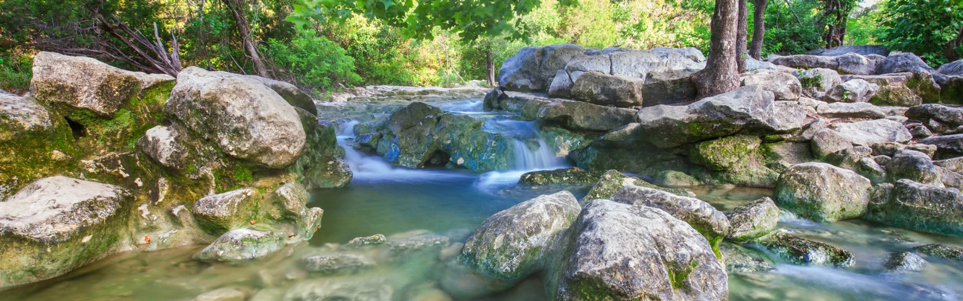
- Barton Springs
Barton Springs has been called "the soul of Austin" with a history of human activity that dates back at least 10,000 years. It is the main discharge point for water that enters the Barton Springs segment of the Edwards Aquifer.
There are four springs that make up the Barton Springs complex, and all four springs provide habitat for the Barton Springs and Austin blind salamanders.
Eliza Spring
Eliza Spring is inside the fenced-off amphitheater near the Zilker Eagle train station. The amphitheater was built in the early 1900s by Andrew Zilker to serve as an Elks Club meeting space. Spring water bubbles up through holes built in the amphitheater floor and provides natural cooling. Water flows from Eliza Spring down a small stream into Barton Creek. For decades this stream was enclosed in a pipe, but the stream was restored in 2017 to provide additional salamander habitat.
Old Mill Spring
Also known as Zenobia Spring or Sunken Garden, Old Mill Spring is located in Zilker Park on the south side of Barton Creek, downstream of Barton Springs Pool. In the late 1800s, a grist mill was built here, taking advantage of the spring-fed creek. The mill burned down at the end of the 19th century. In 1938, the National Youth Administration began building rock walls around the spring with terraced, stone steps. Like Eliza Spring, Old Mill is closed to the public for salamander protection.
Parthenia Spring
Parthenia Spring, or Main Barton Spring, is the fourth largest spring in Texas and provides all the water to Barton Springs Pool. It has never gone dry in its recorded history, although flow rates vary widely depending on rainfall and drought cycles. Even though Barton Springs salamanders live in the pool, the pool is open to the public year-round. So don’t disturb the rocks and gravel on the bottom of the pool where they live!
Upper Barton Spring
Upper Barton Spring is located in Barton Creek upstream of Barton Springs Pool. It is the only one of the four Barton springs that is unaltered by dams or walls. Upper Barton Spring only flows when Barton Springs discharge is at moderate or high flows, greater than about 40 cubic feet per second. The salamanders retreat with the water level and are thought to live within the aquifer until the spring begins to flow again.
Water Quality
The water quality at Barton Springs is quite good! It meets contact recreation standards most of the time, except after storms when rapid recharge can cause bacteria levels to be elevated.
Although water may be safe to swim in, you should not drink water directly from Austin-area springs. Water from most urban springs would not pass drinking water safety standards, especially after storms. It could make you sick. The water in underground aquifers refills from rain and irrigation water that first flowed over the land, which is why we have Water Quality Protection Lands in the environmentally sensitive recharge and contributing zones for Barton Springs. In urban areas, this water may flow over roads, parking lots, lawns or dog parks. As a result, this water typically contains bacteria, viruses, parasites, lawn chemicals, leaked gasoline, or other potentially harmful pollutants
- Visit Barton Springs
- Salamanders
- Barton Springs Flow Data from the United States Geological Society
- Mapping the Edwards Aquifer
We can better conserve and protect groundwater by knowing where it is and how it got there. Water that starts out on the surface can flow underground and become groundwater, especially in a karst system like the Edwards Aquifer. There are six creeks that are major contributors to recharging Barton Springs – Barton Creek, Williamson Creek, Slaughter Creek, Bear Creek, Little Bear Creek, and Onion Creek. Onion Creek is the largest contributor to Barton Springs under normal conditions. However, in drought conditions, the Blanco River can be a significant source of water. Water may move through the Barton Springs segment of the Edwards Aquifer at a very fast rate of up to four miles per day.
How do we know this? Through dye tracing! There are pathways within the limestone for water to enter and move through the aquifer. Dyes can be used to track how water flows through these pathways.

In 1996, we partnered with the Barton Springs-Edwards Aquifer Conservation District to begin mapping water movement in the Barton Springs segment of the Edwards Aquifer. Non-toxic, fluorescent dye was injected into caves and sinkholes. The goals were to trace the water going into the aquifer at various points, measure flow rates, and determine which wells and springs the water would emerge from. This information is helpful to protect water quality. Since then, researchers have performed many dye trace studies that enabled us to map the aquifer flow paths and identify land to protect and preserve water quality.
Flow path of groundwater to Barton Springs - East Austin Springs
Springs on the east and west sides of Austin differ. Springs east of I-35 often develop in shallow, discontinuous aquifers made up ofalluvium. This is a mixture of silt, sand and gravel deposited in former channels of the Colorado River. Groundwater follows the path of least resistance. In East Austin the water moves slowly through small spaces between sediment and rock particles until it reaches clay or other material which it can’t easily pass through. Then it flows out to the Earth’s surface where the alluvium and clay meet.
Many East Austin springs are hard to spot. Their flow may be light because water moves slower through sand and gravel. They may be covered by roadways or buildings, making them difficult to spot except during very wet weather. East Austin springs sometimes appear as a soggy spot in a field or a small trickle running across a driveway. You could easily mistake them for a leak from a water pipe!
Springs in East Austin played an important role in our city’s history. They provided water to settlers and supported the development of farms, homesteads, and forts. Today they continue to play an important role in providing baseflow, or the water in creeks between rainfall events, to our East Austin streams. Even a trickle of flowing water can create an oasis of plant life and wildlife habitat.
Coleman Spring
You can visit Coleman Spring in the Blair Woods Preserve. Residents of Fort Coleman used this spring for their drinking water from 1936 to 1938. A dairy farm was located at the spring until Dr. Frank Blair, a zoology professor at The University of Texas at Austin, bought the land. He gifted it to the Travis Audubon Society in 1985.
Water seeps out of the spring and runs through the property during much of the year. The near-constant supply of water provides habitat for wildlife, such as insects, crawfish, and frogs.
A small dam, constructed from old student essays, forms a pond. Dr. Blair named it “The Dam of Words.” The pond provides a reliable source of water for birds and other wildlife. Excess pond water flows over the dam into a small creek and eventually flows off the property to Fort Branch Creek.
- Find a Spring Near You
Interactive Map
Springs are mapped on the Property Profile interactive map. If you're new to this tool, follow these instructions:
- Click on the “Layers” tab at the bottom of the left menu
- Scroll down and click “Environmental”
- Scroll down and click “Spring”.
- Zoom in on the map and see the springs that we have identified in our database!
Static Map

Blue Dots show the locations of springs in the Austin Area.
Water Quality Monitoring
We partner with the U.S. Geological Survey and the Barton Springs Edwards Aquifer Conservation District to maintain instrumentation and monitoring wells for groundwater in our area.
- For more information on wells, visit the Barton Springs Edwards Aquifer Conservation District.
Report Leaks and Springs
Sometimes there is water flowing on the surface that we don’t know the source of. We are often called upon to determine whether it is from a natural spring or a leaking underground pipe. We analyze the chemistry of the water and investigate the surroundings to make the determination.
If you see water flowing in the city and are unsure if it’s coming from a natural spring or from a leaking pipe, call 3-1-1 or 512-974-2000, so the City of Austin can investigate the source. You can also make a 3-1-1 request online or through their app. Find out more about contacting 3-1-1.