Explore Austin’s Community Tree Priority Map
In 2020, the City of Austin's Community Tree Preservation Division released the Community Tree Priority Map. This resource prioritization tool is for everyone to use including city programs, partners, policymakers, Urban Forest Grant applicants, arborists, and more. It provides access to relevant data comparable across Austin’s neighborhoods. For example, tree canopy data helps uncover disparities in historically under-canopied areas. This enables people to decide where activities like planting, tree care, and community outreach could occur around Austin.
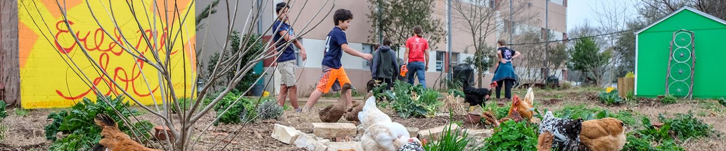
Developing the tool entailed consulting with many people, including arborists, planners, tree planters, students, and others. The City's Youth Forest Council and Park Ranger Cadets engaged with and endorsed the recommended data to be used in the Priority Map. During that process, they expressed their admiration for trees through words of gratitude. One youth participant wrote,
“I am thankful for the shade trees bring on hot summer days. I am thankful for the way they calm me down so I am able to listen to nature and feel at ease. I am thankful for the clean air they give me so I am able to breathe.”
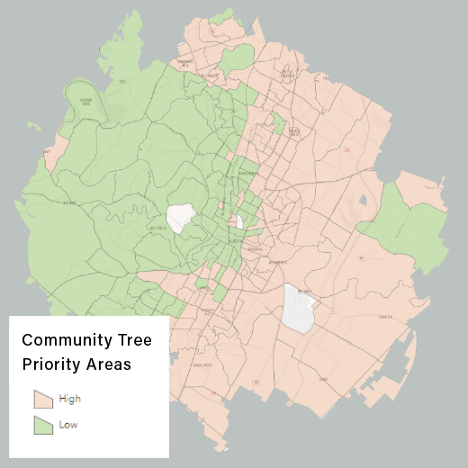
The map matches survey priorities with data points including tree canopy, temperature, mental health, and air pollution. It then bakes this info into a simple score. In the map, the orange zone equals a higher score and higher scores mean higher priority. These neighborhoods are where we recommend investing most heavily in new trees and community stewardship projects.
In the end, priority areas help us gauge success. For instance, are activities like tree planting occurring in higher priority areas? So far the data tell us, that 60% of tree planting occurred in the moderate to highest need areas over the last five years. Moving forward, we will encourage and prioritize tree planting, tree care, education, and inspiration projects in these areas.
Austin’s Community Tree Priority Map
Interested in learning more? View the interactive map here!
Ready to play? Download the data for your analysis here.
About the Map
The Community Tree Priority Map is organized into 2 categories, High and Low Priority. Nine data inputs are standardized and summed across the categories of Environment, Social Vulnerability, Community Investment, and Health & Well-Being. Each category was normalized to minimize its impact on the priority score.
Article contributed by Alan Halter, GIS Analyst Senior with the Community Tree Preservation Division. Email your questions to Alan by clicking here.
Additional Information
Stewardship Investment: The Community Tree Report seeks to share how the City invests in the activities that support Austin’s urban forest and community of stewards. The Report features investment visualizations, an interactive map of projects, and the raw data for your analysis project.
Urban Forest Benefits: Urban Forest Inventory and Analysis Program (UFIA) completed an assessment in Austin in 2016. Austin’s urban forest monitoring program produces estimates of the quantity, health, composition, and benefits of urban trees and forests.
City of Austin Strategic Direction 2023 (SD23) Alignment: The Community Tree Priority Map supports the SD23 Government that works for all (GTW.10).
Do you have an idea to benefit Austin's urban forest in a high-priority area? We encourage you to explore and apply for the Urban Forest Grant, which can help fund your tree planting, care, education, and inspiration projects.