Our Department gets calls from concerned community members about unusual colors seen in creeks. Some of these vibrant colors are natural, so here’s a quick guide to help identify some of the possible sources that cause these unusual sights.
Our environmental scientists encounter a lot of strange and colorful things in our creeks. Orange slime, purple fluffy goo, and rainbow sheens on the water would all appear to be pollution problems, but often it is just a natural phenomenon. Each of these things can be harmless bacteria just doing what they normally do, which is abnormally fascinating. If you suspect what you are seeing is not naturally occurring and a pollution source…
As people migrate to a new area they intentionally or unintentionally bring plants and seeds from lands far off. Due to a variety of physical and environmental limitations many of these plants would not have been able to relocate at such great distances without the assistance of a modern biped. Whether transported to their new locations for food, medicine, aesthetics, or accidentally their arrival can be seen as an invasion on the previous plant community which is already under attack by the concurrent changes in land use (farming, ranching, urbanization).
A majority of these new plants continue to require special attention to grow and spread but a few have great reproductive succe…
Our city is built within a natural environment full of amazing plant and wildlife species. Below is a list of 10 field guides we developed to help nature lovers and explorers, gardeners, anglers, and others identify some of the plant and animal species found in Austin’s creeks, lakes and parks.
Plant Guides
For many years, the City of Austin’s Watershed Protection Department (WPD) has studied trees and other vegetation that grow along local creeks. These vegetated areas along the water are called “riparian buffers,” and they benefit our creeks and river by improving water quality and preventing erosion. Most of WPD’s riparian buffer studies have been in central and west Austin; however, a recent study took place in far eastern Travis County, around and east of U.S. 183. This area, located in the Blackland Prairie region, has deep, fertile soils and is mostly agricultural. WPD’s goal was to document conditions of the creeks and their riparian buffers before major development occurs there.
…OMG!! What has happened to my creek? It’s chock full of some sort of horrible, green slime monster!
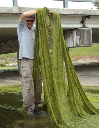
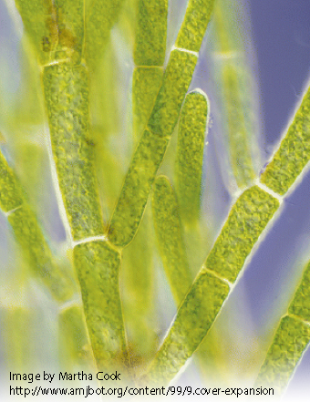
That’s the filamentous algae we call…
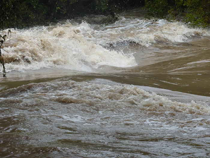
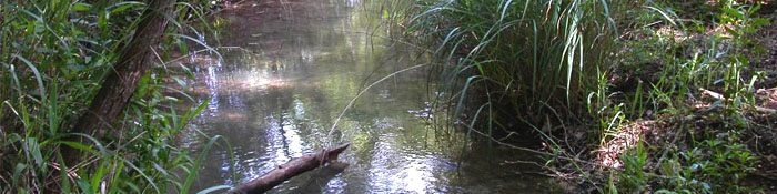
Strong flow in Waller Creek after a significant storm
This may be hard to believe during the hot, dry months of summer, but Austin receives an average of 35 inches of rain a year, or nearly 5 inches more than the average rainfall over the continental United States. Central Texas rain tends to fall in large surges, rather than slowly throughout the year. Heavy rainfall can overwhelm the capacity of natural areas and lawns to absorb and hold the w…
 What happens when you stop mowing along the edge of the creek? You create a Grow Zone. Yes, once you remove the disturbance that is keeping the edge of the creek from becoming a riparian forest, it will start growing back. The first plants to exercise the right over the new place are pioneers that can withstand the degraded soils and harsh conditions created by mowing. Giant Ragweed is often the most common and vigorous one! Thanks to birds and wind bringing tree seeds to the new Grow Zon…
Click here to watch the video!
In Zilker Park, near Barton Springs’ north gate and the Zilker Zephyr train station, you’ll see one of Austin’s environmental treasures – Eliza Spring. To see the spring, look inside the historical, sunken, fenced-off amphitheater.
Eliza Spring is one of four springs in Zilker Park where the endangered Barton Springs and Austin Blind salamanders live. The largest known population of Austin’s unique and endangered Barton Springs salamander makes its home in Eliza Springs.
…
Summary – We’re using swales in parks to slow water down before it enters creeks and you can help!
Urban Stream Syndrome
One of the negative environmental impacts of development is what we call “urban stream syndrome”. The impervious cover created with new buildings and roads prevents rainfall from soaking into the ground. Then we need to get all of this stormwater out of the way so our buildings and roads don’t flood. So we collect the water at inlets and concrete pipes and send it straight to the creek. This can cause erosion in the creeks and contribute to flooding. It also takes any pollutants picked up from the streets directly into our water…

Items illegally thrown on the ground have a significant, negative impact on Austin. Litter pollutes our natural and recreational areas, and the cleanup needed is expensive for taxpayers. Each year, City staff and volunteers pull 250 tons of trash from Lady Bird Lake (in addition to the 6,500 tons removed annually from Austin streets) – some of these discarded items were dropped directly into the river, but most trash washes in from creeks or through storm drains from land-ba…